Load service
The sdi_loadservice bundle allows you to load additional services to your map composition.
To add a service to your app, you have three different options:
-
Select one out of the favorites list.
-
Specify a service URL (manually) in the load service dialog.
-
Use the
serviceURLURL parameter.
|
Configuration for services with HTTP basic authentication
|
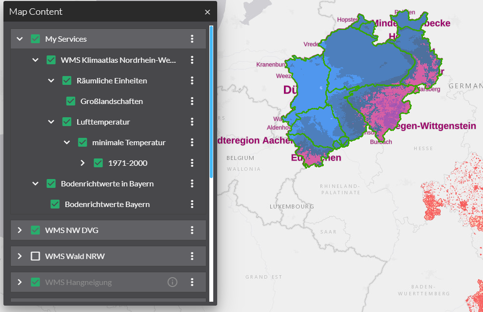
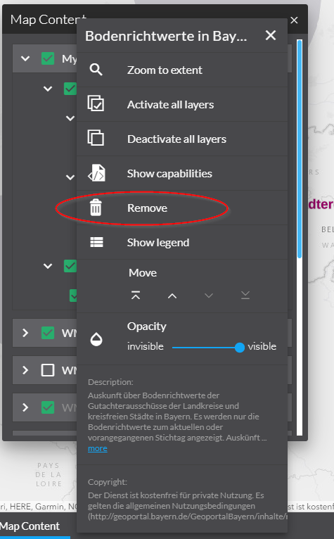
Add a service
serviceURL parameter
For using the serviceURL parameter, the parametermanager bundle is required in your app.
Add the serviceURL parameter to your map.apps app URL, e.g.
http://localhost/mapapps/resources/apps/sdi_demo/index.html?lang=de&serviceURL=https://www.wms.nrw.de/geobasis/wms_nw_alkis.
When the app starts, the layer selection dialog pops up where you have the opportunity to select the layers to be loaded.
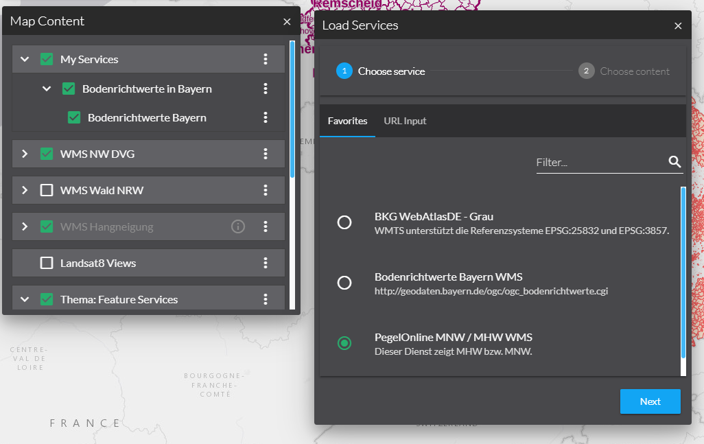
Load by favorites list
The favorites list contains a list of predefined services which makes it easier to load additional services for inexpert users.
Provide the most interesting and useful services here for your users here.
The favorites can be configured in the app.json or in a domain-bundle.
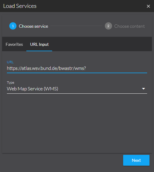
Loading services with their URL
Manually loading additional services is primarily aimed at expert users who are familiar with services and their URLs.
-
In the Load Service dialog go to the "URL Input" tab.
-
Insert the service URL and click "Next".
-
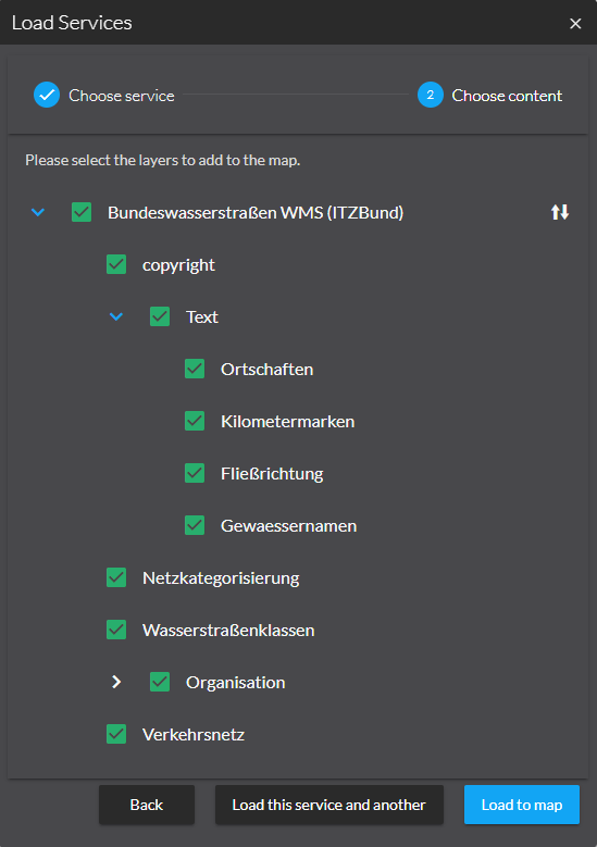
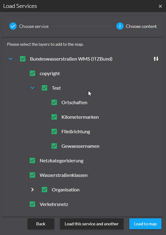
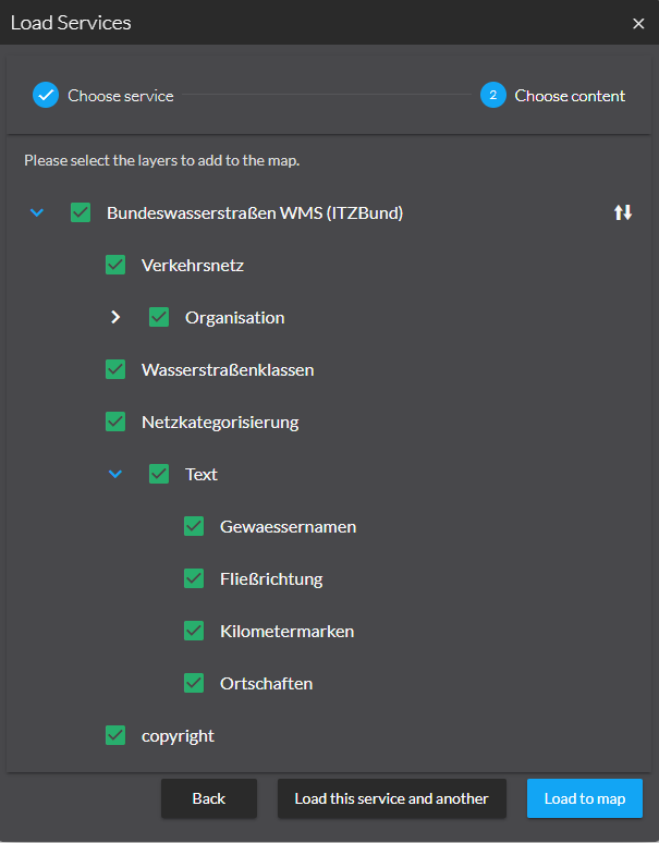
After loading the service you have the option to select and deselect layers and groups. You can reverse the order of the layers before adding them to the map by using the Toggle order button.
The following services types are supported:
-
ArcGIS Server services:
-
Feature Service
-
Map Service
-
Image Service
-
Scene Service
-
Vector Tile Service
-
-
OGC services:
-
Web Map Service (WMS)
-
Web Map Tile Service (WMTS)
-
Web Feature Service 2.0.0 (WFS)
-
Requires GeoJSON output
-
-
OGC API Features
-
-
INSPIRE View Service
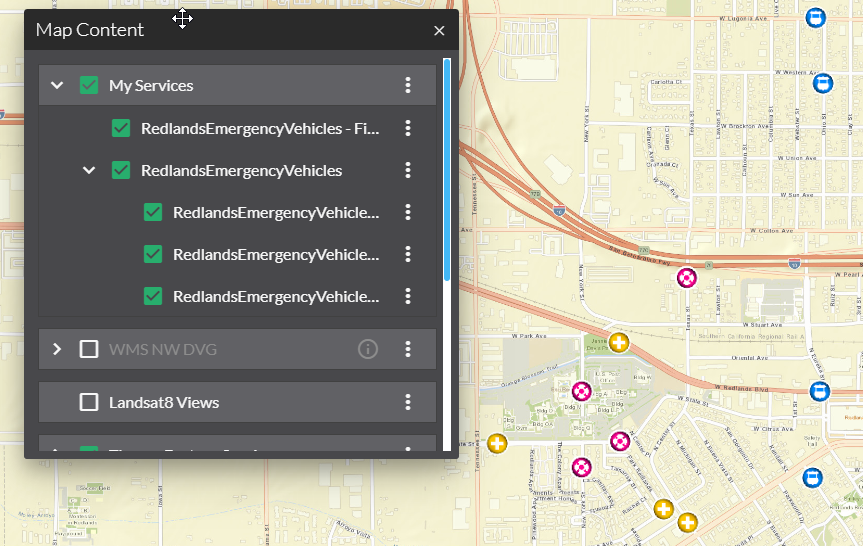
Services with multiple layers
You can load services with multiple layers in two different ways. This is demonstrated below with examples for ArcGIS Server feature service, OGC API Features and the special case of WFS:
ArcGIS Server feature service
-
The whole service as a group using the URL of the service
e.g. https://sampleserver6.arcgisonline.com/arcgis/rest/services/RedlandsEmergencyVehicles/FeatureServer -
Each layer separately with the URL referencing the layer
e.g. https://sampleserver6.arcgisonline.com/arcgis/rest/services/RedlandsEmergencyVehicles/FeatureServer/2
You can reverse the order of layers before loading the layers, but not all servers support requests with a different order of layers. Therefore, after reversing the order of the layers, the result in the map can differ from the order in the TOC.
Before toggling the order:
After toggling the order:
OGC API Features
-
All collections as group using the URL of the API
e.g. https://ogc-api.nrw.de/inspire-us-kindergarten/v1 -
Each collection separately with the URL referencing the collection
e.g. https://ogc-api.nrw.de/inspire-us-kindergarten/v1/collections/governmentalservice